Latest News
LANDFIRE (LF) collects disturbance and treatment polygon data three ways:
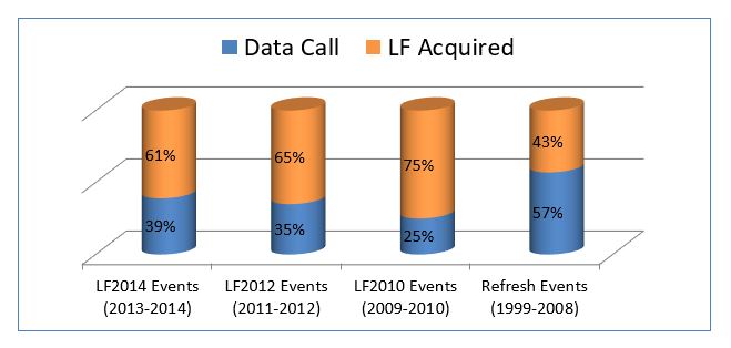
LF Event Data Calls
Percentage of event data contributions compared to data acquired by the LF team during the LF 2016, 2014, 2012, 2010, and 2008 data calls.
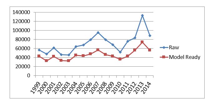
Raw vs. Model Ready Events: Total Number of Records per Year
See READ ME for information on Raw vs. Model Ready Events.
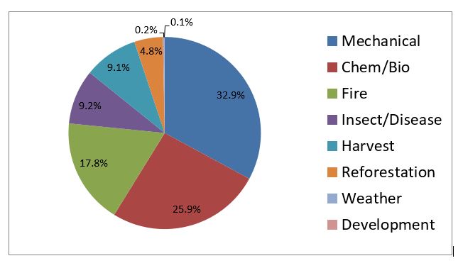
Event Type percentages for LF 2016
Event Type percentages for LF 2016. Data are for 2015 and 2016.
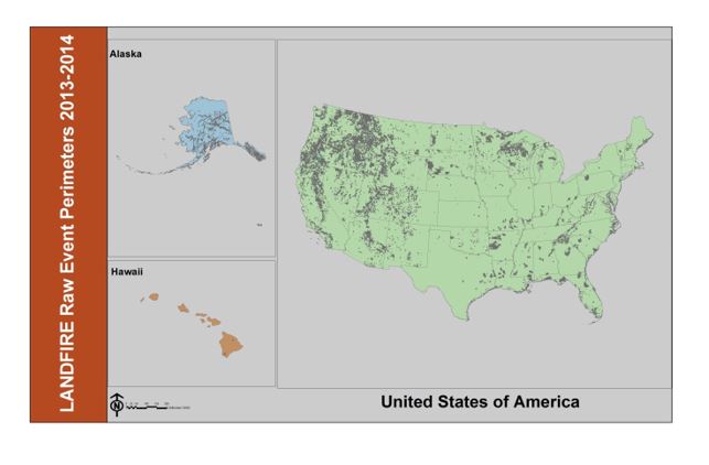
LF 2016 Event Perimeters Map
Event perimeters collected for the LF 2016 update.