


 |
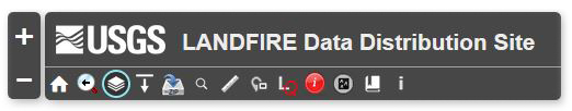
Zoom In - used to enlarge a portion of the map. One can either click on this icon or use the mouse's wheel option to zoom into an area on the map. Once zoomed in, use the mouse to scroll the map to left or right to get the exact area desired.
|
||||||
 |
Zoom Out - used to minimize a portion of the map. One can either click on this icon or use the mouse's wheel option to zoom into an area on the map. Once zoomed out, use the mouse to scroll the map to left or right to get the exact area desired. |
||||||
 |
Default Extent - allows user to zoom out to the full extent of the viewer. | ||||||
 |
Previous Extent - allows user to zoom out to the previous extent of the viewer. | ||||||
 |
Layers - offers three tabs that allow the user to turn available layers on and off, change the Opacity (transparency) of the layer, or view the Legend associated with each layer being viewed. | ||||||
 |
Download Tool - activates the menu so the user can select one of three options to download an area of interest: draw a box, download area by template, or enter the corner coordinates for a study area. | ||||||
 |
Download U.S. Insular Areas - provides links to download the zip files for each insular area. | ||||||
 |
Search - allows the user to zoom to a specific location using a Geographic Names Information System (GNIS) text search. Use various combinations of city names, county names and/or state names. |
||||||
 |
Measure - has three measuring tools that are activated by clicking on the graphic within the first panel of the widget.
|
||||||
 |
Overview Map - displays a small map. The gray box represents the area on the main map that is currently visible. Clicking on the gray box and dragging it will move the viewable area of the main map. |
||||||
 |
Legend Query - allows the user to view the legend color and description for a specific point based on the raster layers currently displayed. |
||||||
 |
Identify - allows the user to click anywhere on the map to display the imagery source information for non-raster data. |
||||||
 |
Elevation Tool - provides an interface to the USGS Elevation Query web service and allows for elevation queries to be performed. |
||||||
 |
Bookmarks - predefined locations that can be selected to quickly view a particular area or region in the map. The four panels within this widget, are shown below.
Custom Bookmarks - Add a bookmark for your area of interest to be able to return to the location again. NOTE If you clear your cache in your browser, you will lose these bookmarks. |
||||||
 |
Information - This is the help and information portion of the menu. |


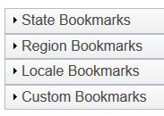
 State Bookmarks - choose one of 50 state links to zoom to the selected state.