Frequently Asked Questions (FAQs)
Use keywords to find the FAQ containing the information requested.
If you do not find the question you're looking for, please try the LF Helpdesk Dashboard for more questions from users and their resolutions.
Q. How do I classify a raster using LF Data with QGIS?
- Install the Raster Attribute Table (RAT) plugin, install: https://plugins.qgis.org/plugins/RasterAttributeTable/
- Add the raster file to QGIS
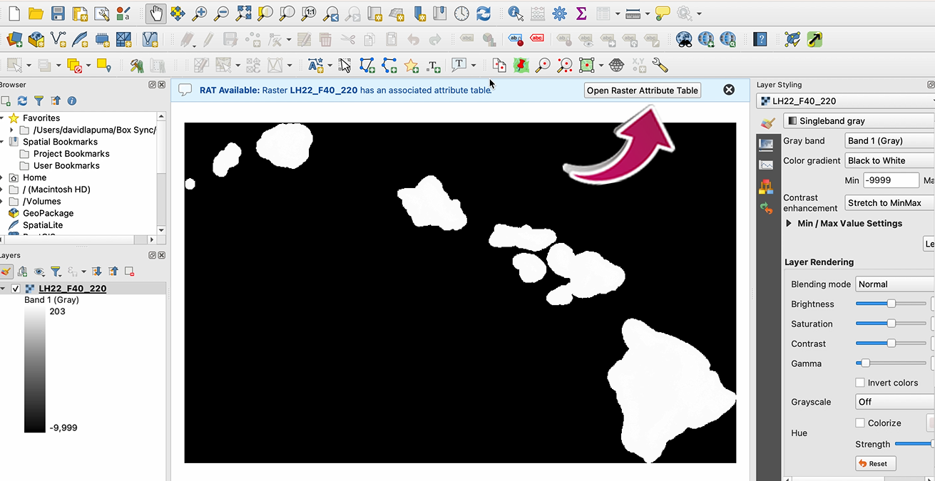
- If a RAT exists you will see the RAT available bar, shown below
- If data was downloaded from LF Viewer or from the website page for Mosaic Downloads, the attribute table is included
- If data was downloaded from the LFPS tool, an attribute table can be found at LF library (CSV)
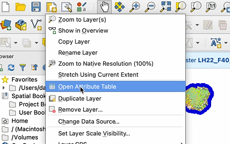
If you do not see the RAT available bar, right click on the raster file, and either select your attribute table, or add your attribute table
Open the RAT
 Select your Classification from the drop-down: (FBFM40) Red, Green, or Blue
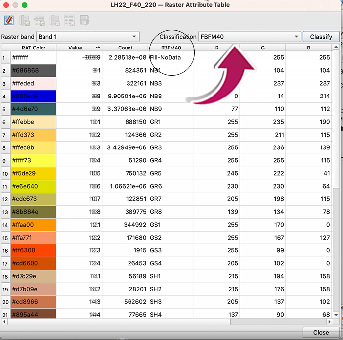 Click on the Classify button
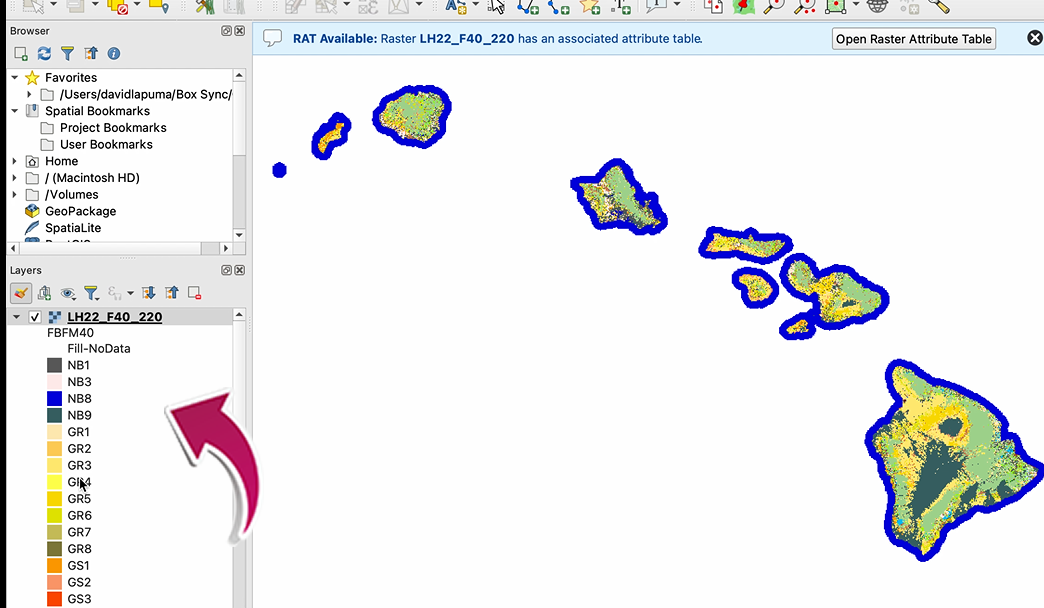
- A pop-up window will ask if you want to overwrite the existing classification--select YES
The attribute table should now appear in QGIS.


 Latest News